| |
| Killarney |
| The traffic on highway 69 thins out once one gets past the
popular cottage country around Muskoka. Turning onto highway 637, the long,
lonely stretch of road that leads to the town of
Killarney
and nowhere else, traffic completely disappears. The solitary drive puts one in
the right frame of mind: this is truly back country; visitors here mostly drive
at least three hours from the nearest populated areas in southern Ontario
to camp, hike, canoe, and sail. Killarney
Provincial
Park, sometimes called the ‘crown jewel’ of Ontario’s parks, is a vast tract of wilderness well known for its magnificent
scenery. The campsites in the park are perpetually fully booked, but perhaps
because of the relatively small number of sites available, this vast wilderness
park never seems crowded, even during peak season at mid-summer. |
|


Killarney Sailing
Route
Killarney Park Area
|
|
|
|
We had planned to break our one-week camping-sailing trip
in two parts to cover the areas east and west of Killarney: land camping at a private camp ground near the town of Killarney
for the first half, and then sailing-camping for the second half by launching
from the Chikanishing Access Point and sailing up Collins Inlet. This avoids
having to sail from Killarney through ten kilometers of
Georgian Bay
open water. Staying at a private campground was not by choice – Killarney
Park
was completely full. But it turned out that camp sites at Roche’ Rouge
Campground are very spacious, with a beautiful view over Killarney
Bay
and overlooking the La Cloche Mountains. There is even a dock for the Hen, at
only a short walk from our campsite.
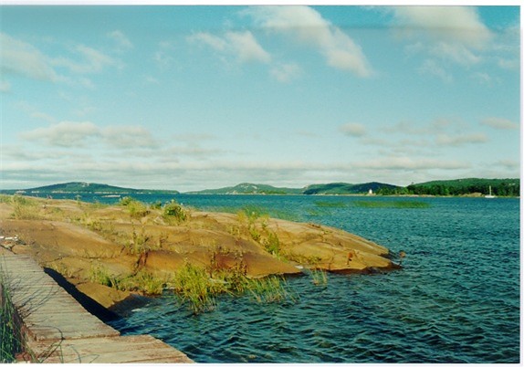
Boat Dock at Campground
|
|
|
|
The weather this summer has been extreme: wet and cold all
of June, and then dry and hot all of July. There is a fire ban in place; no
campfire is allowed. And then today a low-pressure front arrives, bringing rain
and wind. Across
Georgian Bay
a steady 10 knot south wind has been blowing all day, and at this northern tip
of the vast body of water, even with only modest wind, wave height builds up and then further crests as it
reaches land. We take the one-hour walk down the East Lighthouse Trail to watch
the waves. The shoreline here is exposed to the constant effects of wind and
wave, and the rugged trail winds through steep, rocky outcrops, cliffs
overhanging the blue, rushing water, and pebbly beaches. We watch huge lake rollers driven by the south wind approaching, building up to ten-foot, cresting
monsters, and crashing onto the rocky shore with thunderous roars. Camping on
solid ground is not a bad idea, after all.
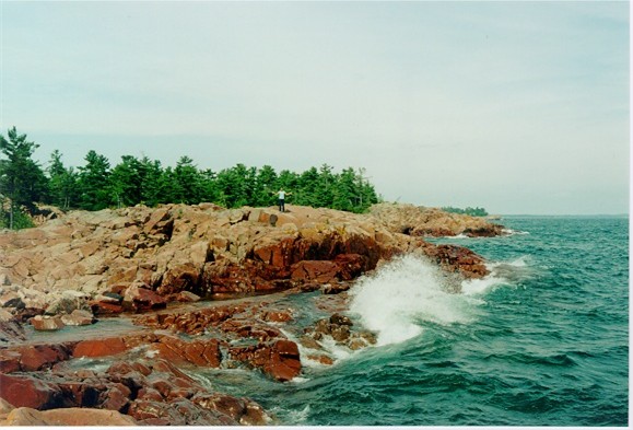
Big Waves, Georgian Bay
|
|
|
|
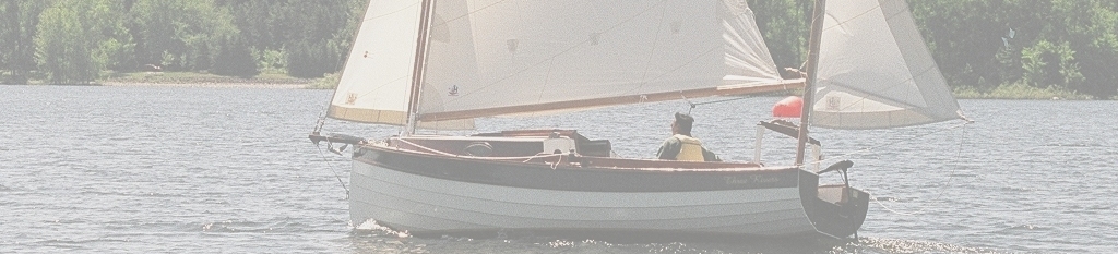
Sailing at Killarney Bay
Hiking
Sail to Baie Fine |
|
|
|