North Channel
North Channel Ben Ho Fall 2007
Killarney
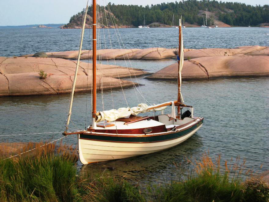
Boat Launch: 2é Fair. The public boat ramp at Killarney is located at the middle of this small town, right by the famous Herbert’s Fish & Chips. The area for setting up boats is small, and during the summer the ramp is busy, as Killarney is one of the few launch points for trailerable boats to embark into the waters of the popular North Channel. The concrete ramp is solid, but the shore is over 1 meter above water, so tying up the boat and getting into it after launching is a bit of a challenge.
Sailing: 4é Excellent. North Channel is rated as one of the ten best sailing grounds in North America. Pristine bodies of water are surrounded by diverse landscapes, and most are perfect for sailing for boats big and small.
Scenery: 4é Excellent. This majestic, mountainous part of Ontario is mostly wilderness, and begins at the East with the high quartz ridges of the La Cloche Mountains that were once higher than the Rockies. Some outlying islands such as the well-known Benjamin Islands have excellent beaches. Just about twenty miles form Killarney lies Baie Fine, a narrow waterway with tall, white quartz ridges on both sides, shapes like a fiord.
Amenities: 3é Very Good. Several towns such as Killarney, Little Current, and, farther to the West, Gore Bay, all have well-stocked stores for provisioning, and Little Current in particular caters to boaters and has excellent marina facilities.
.
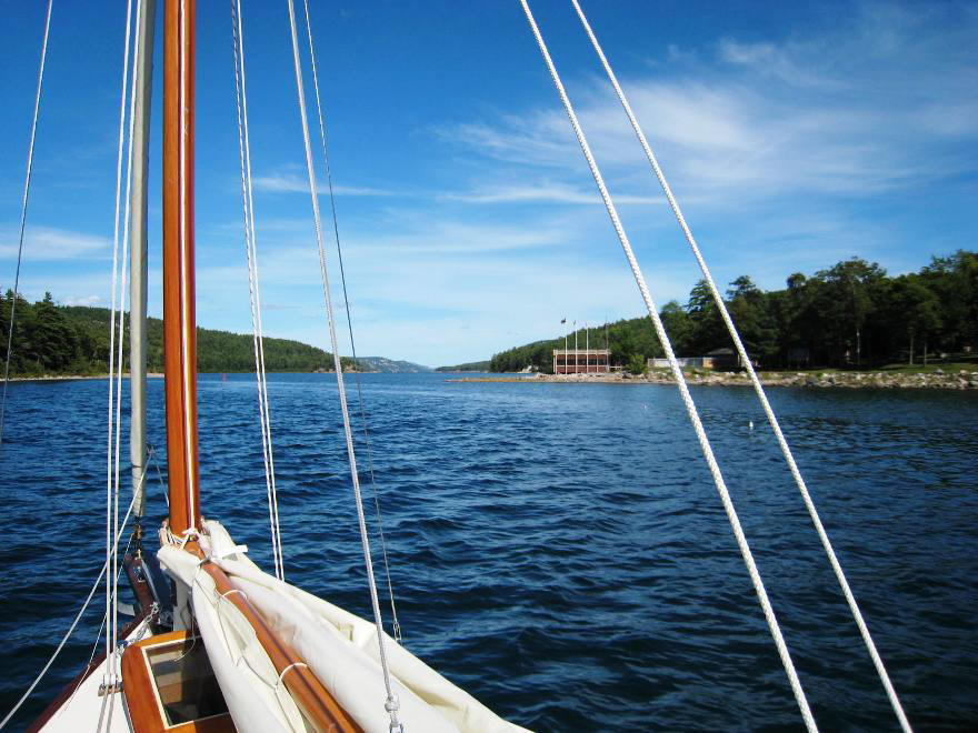
Day 8 of our trailer-sailing trip. The weather at Midland held up just long enough for us to put the boat back on the trailer and had it de-rigged, and then it started to pour. Later we were to find that the highway wind forced rain water through the hatch into the cabin, and part of the berth was drenched. But at the end of the 4 hours drive to Killarney, the weather cooperated and the sky began to clear up. The boat ramp area is right in the middle of town, and rigging up Three Rivers was a spectacle for passer-bys who mostly have not much else to do in this lazy Sunday afternoon. People stopped to chat and wanted to know about this little sailboat. After much interruption and boat talks – the most welcome kind – we launched the boat and motored through the Killarney Channel towards Badgeley Point, a finger of land that’s part of the South La Cloche Range. The sky cleared into a beautiful blue, simmering off the sparkling water:
Motoring towards the Lansdowne Channel
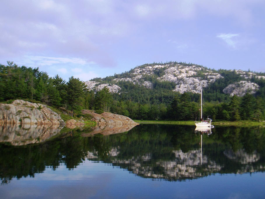
Our destination was Snug Harbour, a beautiful, sheltered cove off the Lansdowne Channel, several miles from Killarney. This is one of the few anchorages in the area with water deep enough for large sailboats, but in this late-summer afternoon it was quiet with only three other boats. We beached Three Rivers and prepared supper while watching the sun set.
Snug Harbour anchorage
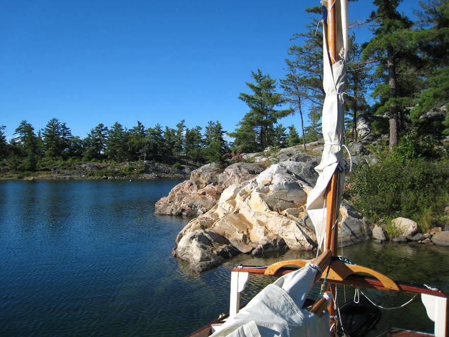
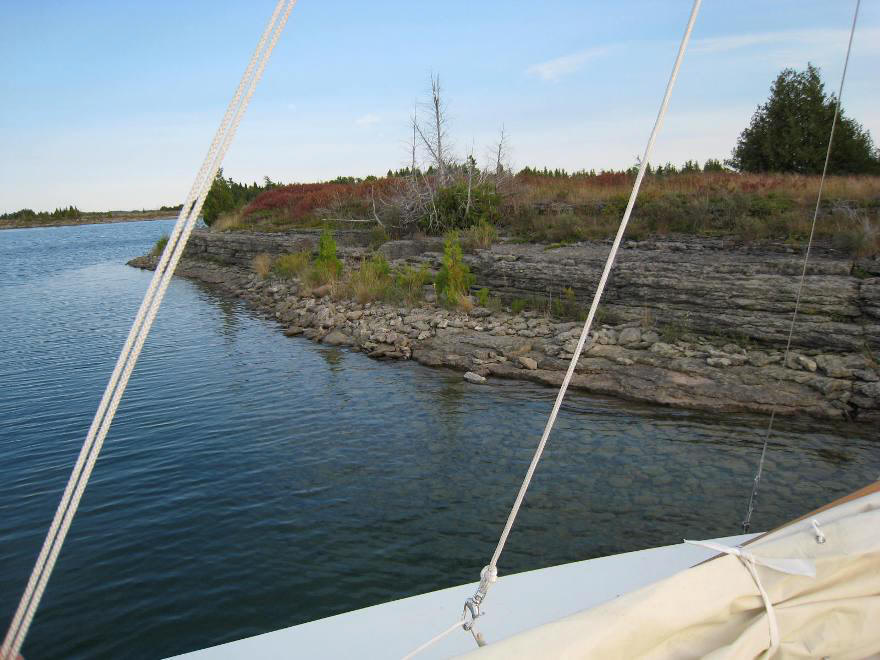
The next morning we woke up to a beautiful day, blue sky with cotton clouds. A light breeze on the stern took us across Frazer Bay towards Baie Fine. Much has already been written about the impressive, fjord-like sceneries of Baie Fine that this is a must-go place, at least once. At the end of this long channel is a small pool of water enclosed by white quartz mountains, famously known as “The Pool”. However to reach The Pool requires motoring about ten miles through some not-so-friendly, rock-littered water. So after a day of leisure sailing in Frazer Bay, we stopped at a little clove just inside of the entrance to Baie Fine, under the Frazer Bay Hill. The chart shows this bay to have a depth of 0, but actually there’s sufficient depth for keel boats. Anchoring was a bit tricky here with the weedy bottom, and the shores were all steep rocks with no place to beach the boat. Fortunately there was little wind and the anchor held. We shared a quiet evening with two larger sailboats there.
Frazer Bay

Entrance to Baie Fine
“The Pool”
No-name bay off Frazer Hill
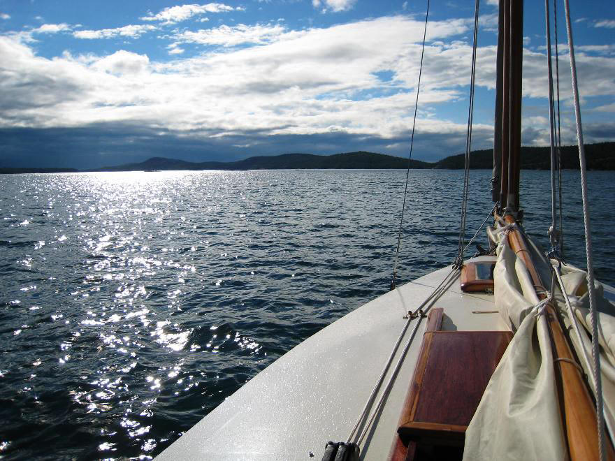
The next day we continued towards Little Current, about 15 miles away. My newly installed GPS/Chart Plotter turned out to be quite helpful, as all the islands soon looked alike. Wind was coming from the West, and by the afternoon it was blowing steadily at about 12-15 knots. With one reef on the main, we had a wonderful sail with Three Rivers driving through the building chops at five knots.
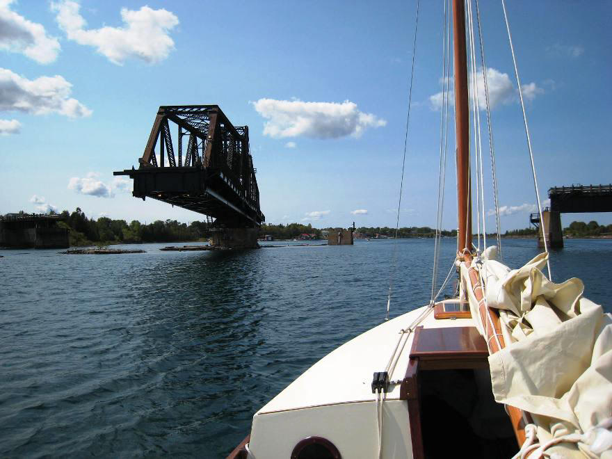
Little Current is named as such for a reason. As a narrow waterway joining two large bodies of water, current can reach several knots depending on the wind direction. Also, there’s a low-clearance swing bridge that only opens once every hour on the hour, and one might face the challenge of battling the current while waiting for the bridge to be raised. I specially put on a 8 HP outboard on Three Rivers for this part of the trip. Fortunately we had it timed perfectly. We were on the approach at 3:04PM, and vehicle traffic was stopped, the bell rang, and the large bridge majestically swung open. – just for us, as Three Rivers was the only boat.
Swing Bridge at Entrance to Little Current
Boardwalk at Little Current
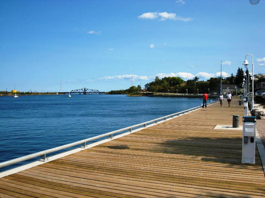
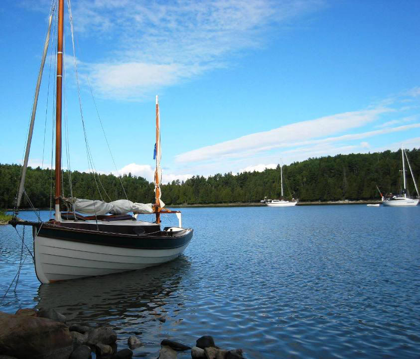
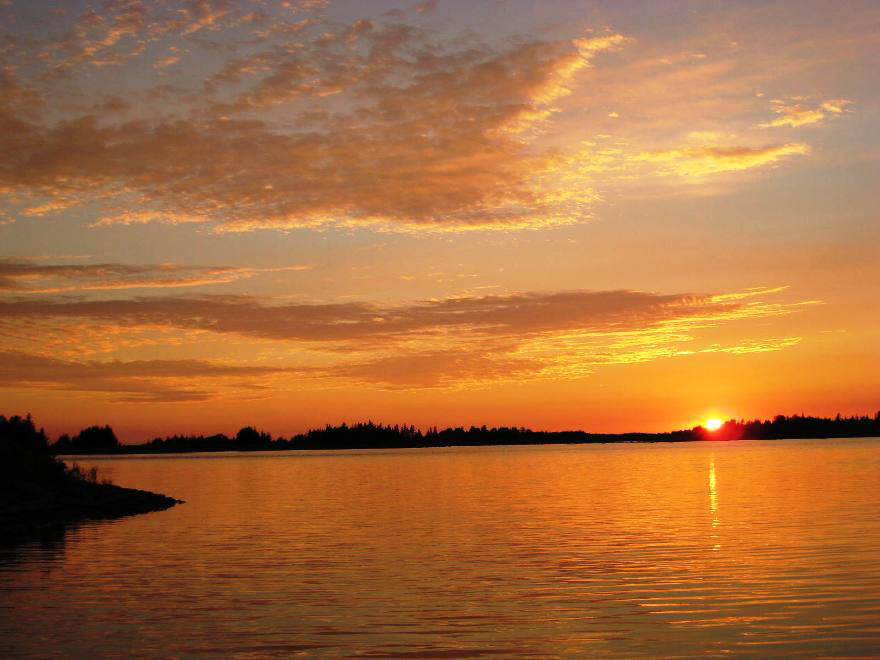
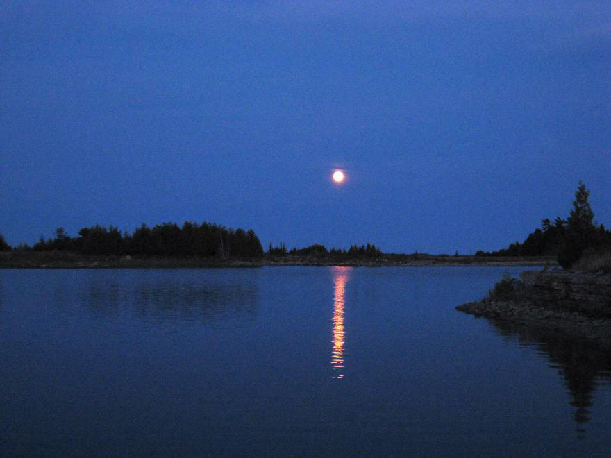
Little Current is a scenic, boater-friendly little town with excellent services. It’s a good place to stop to stretch, get provisions, and have an afternoon coffee before continuing the journey. For a reasonable fee one can also dock overnight. The weather was beginning to turn with another system moving in, and we agonized whether to continue on or to stay here. It was still early, so we decided to press on. We picked a spot from the chart that does not indicate anchorage, but seemed sheltered enough: there is a little bay between two tiny islands, Patten Island and Maltas Island, just a few miles past Little Current. The entrance was shallow and not easy to find, but we managed to get through and found good anchorage with gravel bottom. The scenery here is nothing to write home about, but it provided good shelter from wind and waves. We were rewarded by a gorgeous sunset which was followed immediately by a moonrise.
Anchorage off Patten Island
North Channel Sunset
North Channel Moonrise
The next morning's weather forecast had a small-craft warning with the following: Rain showers; windy; clearing in the afternoon; potential thunder storm at night. We listened to the VHF with boaters debating whether to stay put or head to Little Current for shelter. The weather seemed reasonable then, with about 10 knots wind from South West, a favorable direction if we were to head north up the Waubuno Channel, and Sturgeon Cove is only several miles away and offers protection from south winds. So we moved on, playing it safe and sailing on a run with only jib and mizzen, past boaters all heading in the opposite direction to Little Current.
Shortly we reached a deserted Sturgeon Cove. Comparing to the other scenic anchorages we had in the previous days, this barren cove was a bit of a let down. Since it was only 11:00AM, and the weather still looked manageable, we decided to continue onto the intended destination, Benjamin Islands, about twenty miles to the west. The wind had died down to a whisper, so we shook off the reef and sailed with all sails up. Passing the Bedford Island, wind began to pickup and shifted behind us to the east. Soon it was blowing hard, and the GPS was reading speed over ground at 4, 5, then 6 knots. The displacement hull of the Chebacco was pushing water on a run, going beyond the hull speed of the 20 ft hull. The rudder was still in perfect control and the boat had no sign of broaching, but I was concerned that if the wind kept increasing at this rate it might be a problem. So I took the mizzen down and furled in the jib, just as we were passing through the open water between Amendroz Island and Bedford Island. We stared down a channel streaked with foamy white caps. Immediately the wind became south on the beam, and gusted to over 20 knots. It was a wild ride!
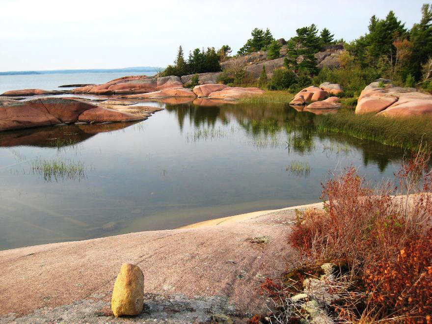
We reached Benjamin Islands by about 4:00PM. By then the wind had died down and the sun came out. We’ve been to Benjamin’s before and had fond memories of its sheltered harbour and beautiful granite rocky outcrops. On this stormy day the harbour was a bit crowded with many large sailboats and power cruisers. We relied on the shallow draft of our boat and found anchorage by nudging between several large boulders.
At Anchor, Benjamin Islands
We had a short hike to explore the island, and reached the western shore to look out to the open water of the North Channel as clouds gathered for yet another storm. I clipped two boaster cables to the metal shrouds on the boat and put the other ends in the water. The theory is that if there’s a lightning hit, the charges will be drawn into the water rather than through the hull. I hope I never have to validate that theory. In the evening, from the safety of our small, cozy cabin, we listened to thunders echoing from distant shores. But the storm never got close.
Benjamin Islands